Cor-Flight Aerial Solutions LLC
Providing aerial solutions today, for the world of tomorrow!

About Cor-Flight Aerial Solutions
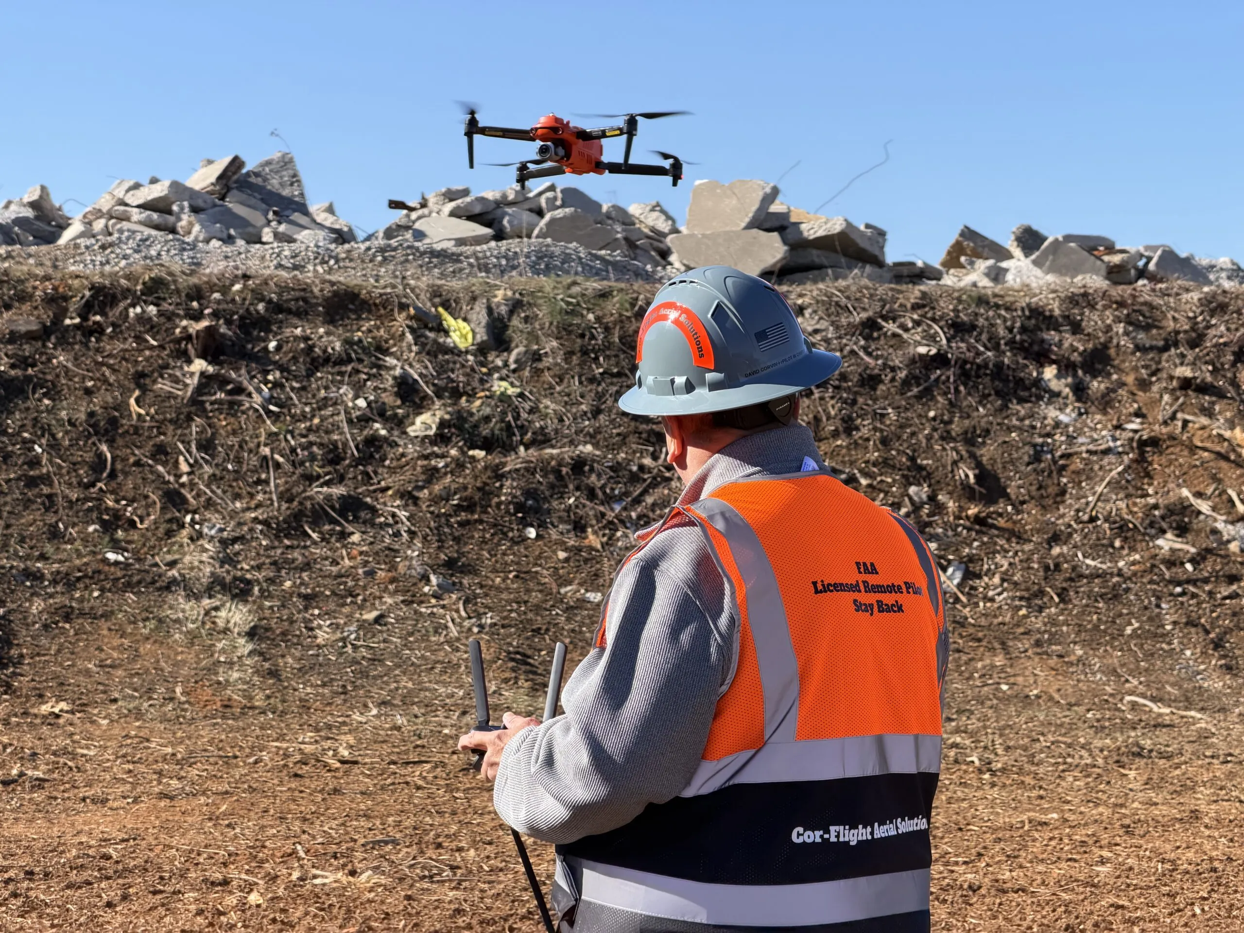
Cor-Flight is a professional aerial data gathering company with deep background experience across law enforcement, construction materials and design, firefighting, medical, security, and many other specialized fields. Our corporate office is located in Richmond, Virginia, with operations centrally based in the Tri-Cities Virginia and Tennessee areas, allowing us to serve our core clientele efficiently while remaining mobile and capable of dispatching to almost any location worldwide. We have recorded over 125,000 photographs and vast amounts of video documentation across an extensive array of subject matter and industries.
We gather all types of aerial data—from basic aerial photography to thousands of images stitched together to create detailed maps and high-resolution imagery for construction, agriculture, real estate, and countless commercial applications. We also record professional aerial video for the same purposes, as well as short film clips for use in the film industry and special events. Our expertise, equipment, and versatility allow us to deliver precisely the visual documentation your project requires, whether you need routine progression documentation or specialized aerial solutions for complex or time-sensitive needs.
Our Services
Construction Progression Photography and Aerial Reports
Weekly, monthly, or quarterly aerial documentation of construction projects from start to finish with GPS precision and consistent positioning. Our high-resolution photos and videos track project progress, material placement, and site conditions, allowing builders, designers, managers, and owners to monitor advancement remotely—reducing travel costs, enhancing safety, and enabling cost-effective project management from anywhere in the world.
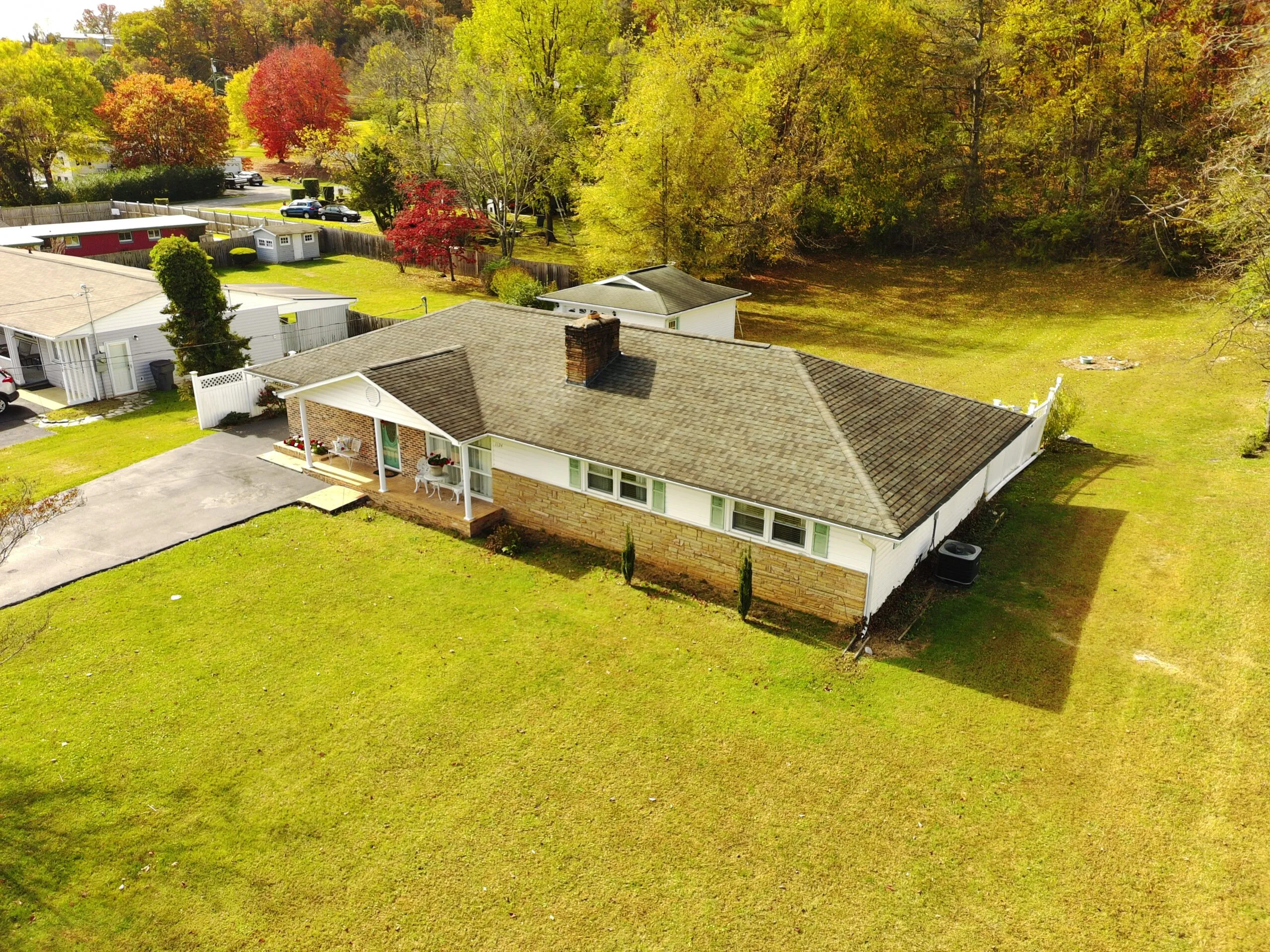
Real Estate Aerial Photography and Fly-Through Videos
Professional aerial imagery showcasing properties, lots, homes, and surrounding areas that significantly enhance real estate listings. Properties documented with drone photography sell up to 68% faster, receive 94% more views from potential buyers, and command approximately 10% higher sale prices—with 83% of sellers preferring agents who utilize this proven technology for competitive market advantage.
Farm and Agricultural Aerial Documentation
Time-saving aerial photography and videography capturing crop conditions, livestock management, fenceline information, and overall farm status. Our detailed aerial reports provide farmers with actionable insights into field health, irrigation effectiveness, and property conditions—allowing for more informed decision-making and efficient farm management without extensive ground-level inspections.
Event Crowd Monitoring and Aerial Surveillance
Professional crowd size assessment and overhead monitoring for festivals, fairs, large gatherings, and special events. Our high-resolution aerial footage provides essential security monitoring, asset tracking, and crowd management information—delivering precision oversight of large events while maintaining attendee safety and operational efficiency from an elevated vantage point unavailable from ground level.
Roof and Maintenance Site Documentation
Safe, efficient aerial inspection and documentation of roofs, maintenance projects, and hazardous areas without requiring workers to ascend ladders, bucket trucks, or dangerous locations. Our drones access difficult-to-reach areas safely, eliminate repeated trips for inspections, provide detailed visual documentation for planning and reporting, and significantly enhance workplace safety while saving time and reducing liability.
Aerial Wedding and Special Events Photography
Creative overhead photography and videography capturing weddings, parties, celebrations, and special occasions from a unique aerial perspective. Our professional drone operators deliver stunning aerial shots and fly-through videos that showcase venues, gatherings, and memorable moments—providing distinctive visual documentation that ground-level photography cannot achieve.
High-Resolution Aerial Mapping and Stitched Photography
Detailed aerial maps and high-resolution composite images created from hundreds or thousands of individual photographs stitched together with precision. These comprehensive aerial maps serve construction planning, property analysis, environmental assessment, and countless commercial applications—delivering detailed visual intelligence from miles away with extraordinary clarity and accuracy.